
Drone services for the emerging 2026 Buy Airspace sector in Wollongong
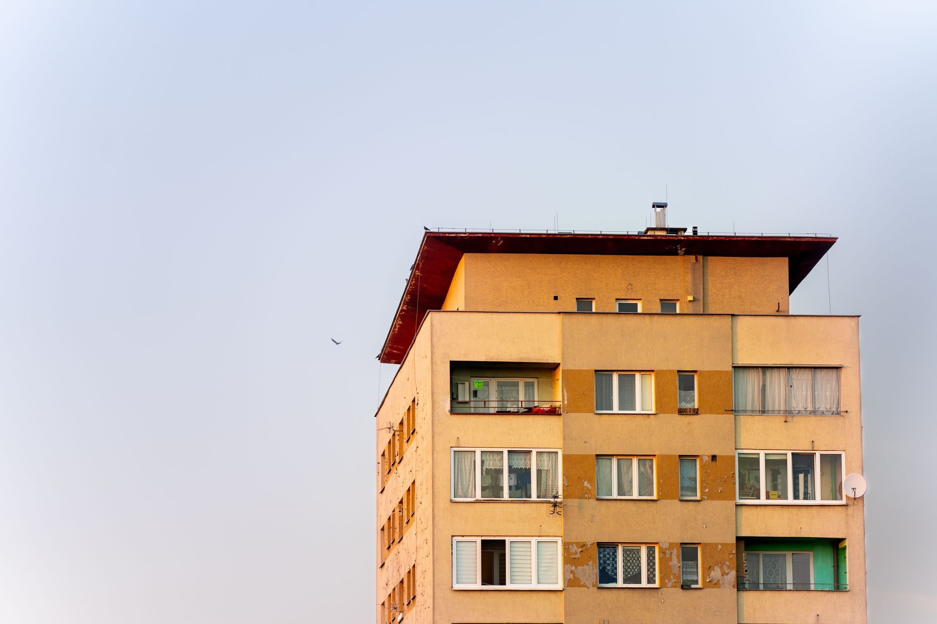
How professional drone imaging can support rooftop housing and airspace deals across the South Coast NSW
Airspace Development
Building lightweight homes or commercial spaces on top of existing buildings - is moving from idea to reality in Australia. Rooftops that once sat idle are now being seen as potential housing and investment opportunities, with airspace deals allowing new floors to be added above strata and commercial buildings.
Specialist organisations like Buy Airspace and the Association of Rooftop & Airspace Development (ARAD) are helping owners and strata committees understand this opportunity and navigate the planning, design and construction steps involved. For the Illawarra, Shoalhaven and Southern Highlands, where councils are already setting a strong pace on housing approvals, that makes rooftop and airspace projects an emerging space to watch.
Professional Drone Imagery works with building owners, councils, businesses and project teams across the Illawarra, Shoalhaven and Southern Highlands on aerial imaging, inspections, construction progress and media content. Those same capabilities apply directly to rooftop and airspace projects in Wollongong and the wider South Coast, where new apartment proposals, mixed‑use developments and infill housing are already reshaping the skyline.
What is rooftop and airspace development?
Rooftop and airspace development is the practice of constructing new dwellings or commercial units in the “airspace” above an existing building, by purchasing or leasing the rights to build additional levels on the roof. It allows owners and developers to unlock hidden value in the space above strata complexes, apartment blocks and commercial buildings without needing new land.
Recent analysis suggests that suitable rooftops across Australia could support tens of thousands of new homes, with some estimates for Sydney alone pointing to up to 150,000 dwellings if airspace development becomes widely adopted. NSW has already announced rooftop housing reforms that explicitly refer to airspace development and rooftop homes as part of its housing mix, including locations within the Illawarra–Shoalhaven region.
Why rooftops and high‑rises matter in Wollongong and the South Coast
Cities like Wollongong already have a growing number of high‑rise and mid‑rise buildings, with new developments and refurbishments underway in the CBD and surrounding centres. Regional planning discussions continue to focus on infill, density and making better use of existing infrastructure.
In that context, rooftop and airspace development becomes a logical future option: using the space above existing buildings to add carefully designed new homes or commercial space, while keeping people close to transport, jobs and amenities.
For building owners, strata committees, investors and developers in the Illawarra, Shoalhaven and Southern Highlands, this is an emerging opportunity that will increasingly require clear site data, visuals and documentation. That is where drone services can add practical value.
How drone imaging supports rooftop and airspace projects
Rooftop and airspace projects need accurate information and strong visuals at every stage. Drone imaging can help in several ways:
1. Feasibility and early concept
Aerial imagery and video offer a clear view of rooftops, surrounding streets and neighbouring buildings. This helps engineers, planners and airspace specialists assess:
- roof form and potential building envelopes
- access for construction, cranes and deliveries
- proximity to amenities, transport and view corridors
- overshadowing, privacy and relationships to adjoining properties.
Research into airspace housing has already highlighted the role of drone imagery and detailed rooftop data in identifying suitable buildings and matching them with planning and housing needs.
2. Planning, approvals and communication
Rooftop projects depend on buy‑in from owners, strata committees, councils and sometimes state authorities. Drone imagery supports:
- planning submissions and design documentation
- visual impact assessments and context mapping
- communication with owners and residents who need to understand how a project will look and function.
Articles on “selling strata airspace” describe developers purchasing rooftop rights and constructing new lots above existing buildings, a process that benefits from clear, shareable visuals at each step, not just technical drawings.
3. Construction, installation and defect documentation
Once approvals are in place, rooftop projects move into construction and installation.
Drone services can assist by:
- documenting site setup, crane operations and modular rooftop unit installation
- providing progress imagery and timelapse sequences for project teams and stakeholders
- supporting defect identification and pre‑handover records by capturing external conditions before and after works.
This is particularly valuable when work occurs above existing occupied buildings, where safe access and minimal disruption are priority concerns.
4. Media, marketing and engagement
Rooftop and airspace developments need more than engineering reports - they also need to tell a story.
Aerial and selected ground content can be used to:
- show how new rooftop homes fit into the wider landscape
- promote projects to buyers, investors or community stakeholders
- support media coverage, website content, social media, presentations and event displays.halovue+1
- Strong visuals help explain why “building up” rather than “building out” can be part of a region’s housing or commercial strategy.
Professional Drone Imagery’s role in the Buy Airspace landscape
Professional Drone Imagery already works across inspections, construction, industrial and media services for clients in the Illawarra, Shoalhaven and Southern Highlands. Those capabilities align closely with the needs of rooftop and airspace projects.
For building owners, investors and developers exploring airspace deals or rooftop concepts, we can support:
- Site imaging and feasibility visuals – current aerial overviews and detail shots of candidate buildings, roof forms and context.
- Inspection and condition documentation – roof, solar and façade imaging to assist engineers and asset managers before refurbishment or new construction.
- Construction progress, mapping support and timelapse – regular capture to show project evolution, assist coordination and provide a record of key milestones.
- Media content for communication and marketing – aerial and ground visuals tailored for web, presentations, investor decks, social media and community engagement.
We operate under a CASA Remote Operator’s Certificate with established safety procedures, flight planning, risk assessments and a focus on compliance in controlled and complex airspace environments. That combination of technical compliance and visual storytelling is particularly important for projects that take place above existing buildings and busy streets.
Why Wollongong and the South Coast are ones to watch
Across NSW, planning reforms and industry analysis are putting rooftop and airspace development on the agenda, with millions of square metres of unused rooftop airspace identified in councils including Wollongong, Shellharbour, Shoalhaven and Kiama. While local policies and projects are still evolving, these centres already have growing skylines, active development pipelines and strong housing discussions - making them places to watch as rooftop and airspace opportunities move from concept to reality.
For building owners, strata committees and investors in these South Coast councils, rooftop and airspace development is not yet mainstream - but it is clearly an emerging possibility. Watch this space as state‑level reforms and local development activity continue to shape how rooftops are used in the coming years.
Working alongside Buy Airspace and industry bodies
Buy Airspace, led by founder Warren Livesey, has brought rooftop and airspace development into mainstream discussion by showing how unused rooftops can be turned into new homes and assets through structured airspace deals. Public commentary and interviews have highlighted the potential value of rooftop airspace, the role of strata communities and the importance of careful design and planning.australianconveyancer+3
ARAD, the Association of Rooftop & Airspace Development, acts as a broader industry body promoting safe, high‑quality rooftop and airspace projects across Australia and internationally. Its work emphasises sustainability, safety and long‑term quality in rooftop development.
For South Coast stakeholders, these organisations offer useful frameworks and resources. Professional Drone Imagery’s engagement with this space is focused on providing the aerial data, inspection support and media content that help such projects move from concept to reality.
Next steps for building owners, investors and project teams
If you own or manage a building in the Illawarra, Shoalhaven or Southern Highlands and are curious about rooftop or airspace potential, your next steps might include:
- understanding whether your building’s rooftop and structure could support additional lightweight units or extensions;
- exploring how airspace deals work and what rights and obligations are involved;
- considering what site data and visuals you would need for feasibility, planning and communication.
- Organisations like Buy Airspace and ARAD provide resources on the legal, planning and commercial aspects of airspace development. Professional Drone Imagery can work alongside those frameworks by providing the aerial imaging, inspection support and project visuals required along the way.
If you’d like to discuss drone imaging for a potential rooftop or airspace project on the South Coast, we’re happy to talk.

Author
Heather James | Chief Remote Pilot
I’m Heather James, CEO of Professional Drone Imagery Pty Ltd (PDI), Chief Remote Pilot, RePL Instructor and photographer. I help businesses with aerial imagery, thermal inspections and photography, alongside accurate site data, to improve oversight, safety and marketing outcomes on every project.
Not sure if your drone project is ready for an estimate? Take our Drone Project Readiness Check to find out in less than 2 minutes.